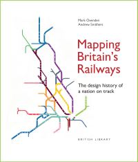
Mapping Britain’s Railways

£25.00

Building on the established success of the British Library’s map books, two outstanding experts in the field of transport mapping navigate the history and design of the British railway network. Merging art and design, graphics and cartography, this book contains over 200 images of railway maps and schemas.

Available to be ordered.
This title is not currently on our shelves, but can be ordered for you – either for home delivery or collection from the shop. This usually just takes a day or two, but we will confirm the expected timeframe when an order is placed.
If you would like us to check availability before you order just contact us here.

SKU: 9780712355896 Category: Tags: , Publisher/imprint : British Library Publishing
Page count : 176
Published on 18th August, 2026

Description

Railway diagrams have been at the forefront of mapping Britain’s railways since they first began operating 200 years ago – a journey from A to B has always needed to be easily and quickly understood.

This book reveals the surprising history of how British railway cartographers have led the way in designing clear passenger information, even predating the iconic London Underground diagram, which itself has expanded to encompass overground routes around the capital and beyond.

Written and designed by bestselling author Mark Ovenden and National Rail mapmaker Andrew Smithers, this intriguing and lively history is illustrated with over 300 colourful maps from around the country, showing the evolution of schematics from simple line drawings to complex diagrams that incorporate ever more information.


Additional information

Dimensions 24 cm
Author

Publisher

Imprint

Cover

Pages

Language

Edition
Dewey

Readership